UAV (Unmanned Aerial Vehicle) or drone survey services in Bangalore have emerged as a cutting-edge and transformative technology in the field of surveying and mapping. Bangalore, often referred to as the Silicon Valley of India, is a city known for its technological advancements and innovation, and it has embraced drone technology to enhance various industries, including construction, agriculture, real estate, environmental monitoring, and more.
Overview of UAV/Drone Survey Services in Bangalore:
In recent years, the use of UAVs or drones has gained significant traction in Bangalore due to their ability to capture high-resolution aerial imagery and data efficiently and cost-effectively. These services have revolutionized traditional surveying methods by providing rapid data acquisition, accuracy, and versatility in a wide range of applications. Here’s an introduction to UAV/drone survey services in Bangalore:
Land Coordinated Technology(lctss.in) UAV/drone survey services in Bangalore represent a technological revolution that is transforming how various industries gather critical data. These services offer precision, speed, and cost-efficiency, making them indispensable tools for businesses and organizations seeking to make informed decisions based on accurate spatial information. As technology continues to evolve, the role of UAVs in surveying and mapping is likely to expand, further enhancing the development and sustainability of Bangalore and its surrounding regions.
Certainly, here are more details about UAV/Drone Survey Services in Bangalore:
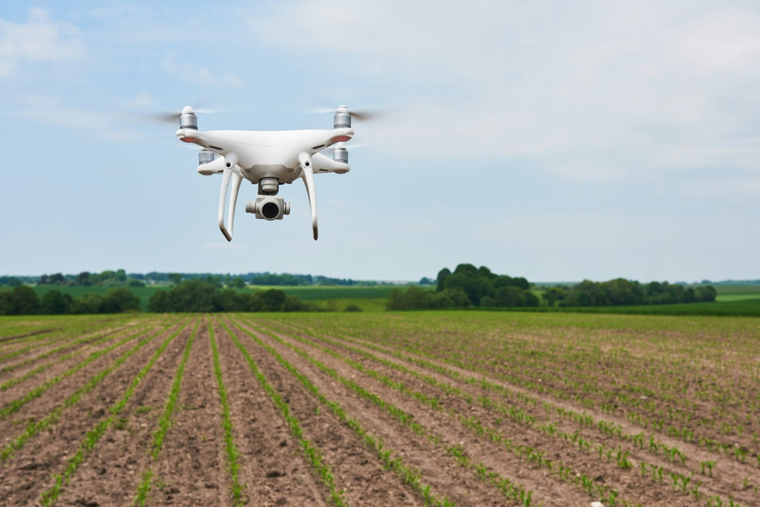
Multirotor and Fixed-Wing Drones: Drone survey services in Bangalore often use a variety of UAV platforms, including multirotor and fixed-wing drones. Multirotor drones are typically favored for their ability to hover and capture detailed images, while fixed-wing drones excel in covering large areas quickly.
High-Resolution Cameras and Sensors: These drones are equipped with high-resolution cameras and various sensors, such as LiDAR (Light Detection and Ranging), thermal cameras, multispectral cameras, and RGB cameras. These sensors allow for capturing a wide range of data, from visual imagery to elevation and temperature data.
RTK and GPS Technology: To ensure precise georeferencing of data, drones often use Real-Time Kinematic (RTK) or GPS technology, enabling centimeter-level accuracy in mapping and surveying.
GIS and Mapping Software: After data capture, drone survey services employ Geographic Information Systems (GIS) software to process and analyze the collected information. This includes creating orthomosaics, point clouds, digital elevation models (DEMs), and 3D models.
Data Integration: Drone-derived data can be integrated with existing geographic data, allowing for comprehensive analysis and decision-making. It enables organizations to make informed choices based on both historical and real-time data.
Customized Reporting: Service providers often offer customized reporting, including detailed maps, reports, and visualizations that are tailored to the specific needs of their clients.
DGCA Compliance: In India, drone operations are regulated by the Directorate General of Civil Aviation (DGCA). Drone survey services in Bangalore must adhere to DGCA guidelines regarding drone registration, pilot licensing, and operational procedures.
Airspace Coordination: These services work closely with air traffic authorities to obtain necessary permissions for flying drones in controlled airspace. This ensures safety and compliance with regulations.
Construction and Civil Engineering: Drone surveys are instrumental in construction site planning, progress monitoring, volumetric analysis, and site inspections, leading to improved project management and cost savings.
Agriculture: Drones aid farmers in precision agriculture by providing data on crop health, soil conditions, and irrigation needs, ultimately optimizing yields and resource usage.
Environmental Conservation: Drones are used to monitor forests, wetlands, and wildlife, aiding in biodiversity conservation and ecological research.
Mining and Quarrying: Drone surveys assist in mine planning, monitoring stockpiles, and ensuring environmental compliance in mining operations.
Utilities and Infrastructure: Power and utility companies employ drones for inspecting transmission lines, pipelines, and infrastructure assets, reducing maintenance costs and downtime.
Cost-Efficiency: Drone surveys are often more cost-effective than traditional surveying methods, as they require fewer personnel and resources.
Speed: Drones can cover large areas quickly, reducing the time needed for data collection and analysis.
Safety: Drones can access hazardous or hard-to-reach areas, reducing the need for personnel to enter dangerous environments.
Accuracy: High-resolution sensors and GPS technology provide precise data, improving the quality of survey results.
Automation and AI: Drones are increasingly incorporating automation and artificial intelligence for tasks like object detection, anomaly identification, and autonomous flight planning.
Urban Air Mobility (UAM): The concept of UAM may introduce drone taxis and cargo delivery drones to urban areas, potentially revolutionizing transportation and logistics.
Expanded Regulatory Framework: The regulatory framework governing drone operations in India is likely to evolve further, impacting the scale and scope of drone survey services in Bangalore.
Drone survey services in Bangalore are continually evolving and finding new applications across diverse industries, making them a vital component of modern technology-driven solutions for spatial data collection and analysis.


