GPR Survey
A GPR survey involves using a specialized antenna to focus electromagnetic pulses (radar signals) of short duration into the ground. These signals propagate and
Read MoreSurveying plays the major role in every Geomatics related projects. Surveying being the sole of the project, it is extremely important right from the planning to development stage of the project. ALG team understand the importance of the surveying part very well. ALG team have done ample number of projects and rendered successful results to our clients. We specialize in basic to advanced surveying techniques.
Land surveying is the process of determining the precise location and measurement of land, including its boundaries, contours, and other physical features. This is typically done to create maps, define property boundaries, and to aid in construction and development projects.

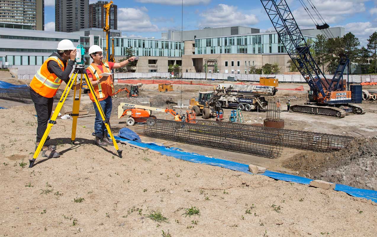
Surveyors use a variety of tools and techniques to gather data about the land, including GPS, laser scanning, and traditional instruments like theodolites and total stations. This data is then used to create accurate maps and plans, which can be used by engineers, architects, and other professionals to design and build structures on the land.
Land surveying has a long history, dating back to ancient civilizations such as Egypt and Greece, where it was used to divide land for agricultural purposes. Today, land surveying plays a critical role in a wide range of industries, from real estate and construction to mining and forestry.
Land surveying is a highly specialized field that requires a combination of technical knowledge, skills, and expertise. It involves the use of various equipment and techniques to measure, record, and analyze data related to land and its features.
One of the most important aspects of land surveying is determining accurate property boundaries. This involves measuring and marking the corners and lines of a piece of land to ensure that it is correctly defined and that there are no boundary disputes or conflicts with neighboring properties.
Land surveyors also collect data about the contours and physical features of the land, such as hills, valleys, and waterways. This information is used to create topographical maps, which are used in a variety of industries, including engineering, architecture, and construction.
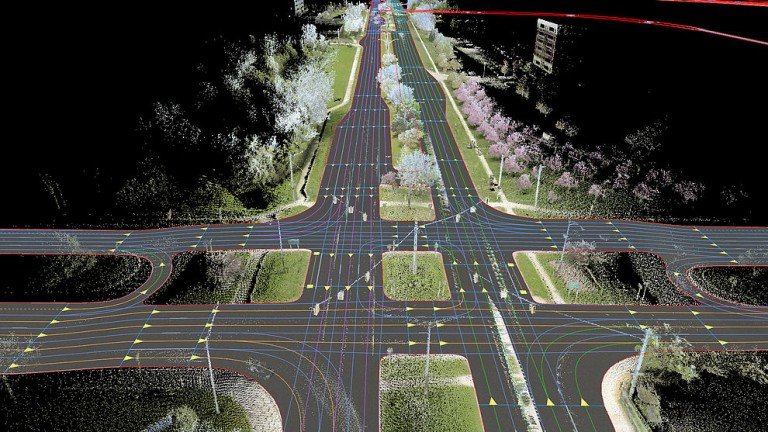
In addition to traditional surveying tools like theodolites and total stations, modern surveyors also use advanced technologies like GPS and laser scanning to gather data about the land. These technologies allow for faster and more accurate measurements, and they can be used to create highly detailed maps and 3D models of the land.
Land surveying is an essential part of many industries, including real estate, construction, mining, and forestry. It is also used in government and public works projects, such as road construction, utility placement, and land-use planning.
Here are some more specific details on the various aspects of land surveying:
Property Boundary Surveying: Property boundary surveying is one of the most important aspects of land surveying. It involves measuring and marking the corners and lines of a piece of land to ensure that it is correctly defined and that there are no boundary disputes or conflicts with neighboring properties. The surveyor will typically use a combination of traditional tools like theodolites and total stations, as well as modern technologies like GPS, to accurately measure the boundaries of the property.
Topographic Surveying: Topographic surveying involves collecting data about the contours and physical features of the land, such as hills, valleys, and waterways. This information is used to create topographical maps, which are used in a variety of industries, including engineering, architecture, and construction. The surveyor will typically use a combination of traditional tools and modern technologies like GPS and laser scanning to gather the data needed for a topographic survey.
Construction Surveying: Construction surveying involves providing accurate measurements and data to aid in the construction of buildings, roads, and other structures. The surveyor will work closely with architects, engineers, and contractors to ensure that the construction project is built according to the plans and specifications. This may involve setting stakes and markers to indicate the location and height of the foundation, walls, and other features of the structure.
Geodetic Surveying: Geodetic surveying involves the precise measurement of the Earth’s shape and gravity field. This type of surveying is used in applications such as satellite positioning, map-making, and earthquake monitoring. Geodetic surveyors use highly specialized equipment and techniques to gather data about the Earth’s surface, such as laser ranging, satellite observations, and ground-based measurements.
Hydrographic Surveying: Hydrographic surveying involves the measurement and mapping of bodies of water, including rivers, lakes, and oceans. Hydrographic surveyors use specialized equipment such as sonar and GPS to gather data about the depth and shape of the water body, as well as the location of underwater features such as rocks and wrecks.
Land Coordinated Technology Company in India, provides the best quality of services in Civil Engineering Surveying, GPR Survey, Land Surveying, and Civil Based Traffic Services etc.

A GPR survey involves using a specialized antenna to focus electromagnetic pulses (radar signals) of short duration into the ground. These signals propagate and
Read More
GIS deals with the information about the earth and its features. The spatial and non-spatial data of the Earth’s surface are managed precisely with the
Read More
LCT has well qualified civil engineers who have esteemed experience in handling civil related works. We have associates qualified from Institution of Valuers.
Read More
LCT has well qualified civil engineers who have esteemed experience in handling civil related works. We have associates qualified from Institution of Valuers.
Read More
LCT has well qualified civil engineers who have esteemed experience in handling civil related works. We have associates qualified from Institution of Valuers.
Read More
LCT has well qualified civil engineers who have esteemed experience in handling civil related works. We have associates qualified from Institution of Valuers.
Read More


LCT provides Training on the Civil and Geomatics platform with its expert trainers. We provide Government of India approved and recognised course.
Get a professional BSS Diploma in Civil Draughts man with our widely recognized certificate programme.
Students get theoretical and practical knowledge from our Industrial experts. Our students are made to develop the skills to face the real world projects confidently.
Drone surveying is a rapidly growing field that uses unmanned aerial vehicles (UAVs), or drones, to collect high-resolution data for a variety of applications such as mapping, construction, land surveying, and environmental monitoring.
View Course DetailsChoose wisely and move ahead in your career by taking the GIS Professional Certificate course from LCT. This is a best course which covers all the advanced technologies in the syllabus. The course will be taught by industrial experts, so the students get abundant knowledge on the technology and the real world projects.
View Course DetailsCAD (Computer-Aided Design) Draftsman training course is designed to train individuals in the use of computer software and technology to create technical drawings and 3D models used in the manufacturing, engineering, and architecture industries.
View Course Details


