


In the evolving landscape of geographical data collection and land surveying, precision and speed are more critical than ever. Whether it’s for urban development, infrastructure planning, or environmental monitoring, the need for highly accurate land measurements and 3D models has given rise to new technologies that are both cutting-edge and efficient. Among these innovations, Lidar Data Processing Services in Kerala have become an essential tool for various industries, and Land Coordinates Technology (LCTSS) is at the forefront of providing these advanced solutions.
Table of Contents
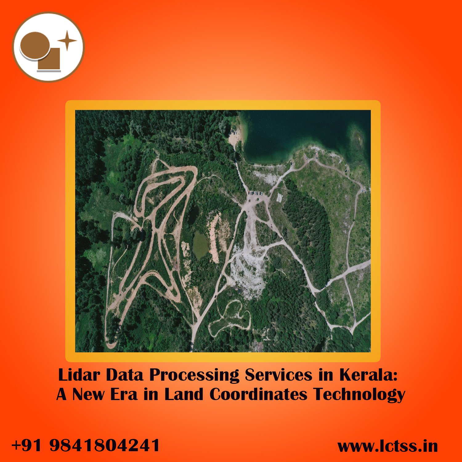
ToggleLidar, which stands for Light Detection and Ranging, is a remote sensing technology that uses laser pulses to measure distances and create highly accurate 3D models of the earth’s surface. When combined with data processing services, it becomes a game-changer in applications like land surveying, environmental monitoring, forest mapping, and urban planning.
Unlike traditional surveying methods, Lidar can capture data quickly and efficiently, even in densely forested or mountainous areas, providing unmatched precision. For Kerala, a state known for its diverse topography ranging from beaches to the Western Ghats, this technology is crucial for addressing both environmental and developmental needs.
Land Coordinates Technology and its data processing arm LCTSS specialize in providing Lidar Data Processing Services tailored to Kerala’s unique landscape. Whether you are dealing with flat coastal plains or steep mountain ranges, Lidar technology offers unmatched accuracy in capturing land coordinates, ensuring that the data is precise down to the millimeter.
But capturing the data is just the first step; processing and interpreting that data is where the real magic happens. This is where LCTSS excels. They take raw Lidar data and turn it into actionable information, such as Digital Elevation Models (DEMs), contour maps, and 3D models, which are invaluable for engineers, architects, and urban planners.
Urban Planning and Development:
Kerala is rapidly urbanizing, with cities expanding into previously untouched areas. LCTSS uses Lidar to create precise 3D models that help planners visualize the landscape, design infrastructure, and ensure the proper development of roads, buildings, and drainage systems. The highly accurate terrain models provided by Land Coordinates Technology allow for optimal resource allocation and better decision-making.
Environmental Monitoring:
Kerala’s rich biodiversity and sensitive ecosystems make environmental monitoring a priority. Lidar Data Processing Services enable the creation of detailed maps that can track changes in forest cover, detect erosion, and monitor water bodies. This is especially important for flood-prone areas in Kerala, where LCTSS can help predict water flow patterns and plan disaster mitigation strategies.
Land Surveying and Mapping:
One of the primary uses of Lidar technology is in land surveying. Traditional methods of surveying are labor-intensive, time-consuming, and often lack precision in difficult terrain. Lidar technology, combined with LCTSS’s processing services, provides a faster, more accurate way to measure land areas, boundaries, and property lines. This can be invaluable for real estate development, infrastructure projects, and public works.
Agriculture and Forestry:
Agriculture and forestry are integral to Kerala’s economy. Land Coordinates Technology uses Lidar to assess crop health, analyze topography for irrigation planning, and even track forest biomass. The detailed data collected can be used for optimizing yields, protecting natural resources, and enhancing sustainable practices.
Coastal Zone Management:
Kerala’s long coastline faces constant threats from erosion and rising sea levels. LCTSS can use Lidar to create precise elevation models of coastal areas, enabling more effective management and mitigation efforts. This technology allows authorities to monitor coastal changes in real time, giving them the tools needed to safeguard both human habitats and natural ecosystems.
While collecting Lidar data is important, processing that data into useful formats is where many businesses and governments face challenges. Land Coordinates Technology has a specialized team at LCTSS that excels at turning raw Lidar data into clear, actionable insights. Their expertise ensures that clients receive data that is easy to interpret and ready for implementation in projects.
Here’s how LCTSS processes Lidar data:
Data Collection: Using state-of-the-art Lidar sensors, data is collected through aerial surveys or ground-based methods. This data includes millions of points, also known as point clouds, which represent the surface being surveyed.
Data Cleaning: Raw data often contains noise or irrelevant information, such as vegetation or structures that need to be filtered out. LCTSS uses advanced algorithms to clean the data, removing these extraneous points to focus solely on the terrain.
Data Classification: After cleaning, the data is classified into different categories—ground, buildings, vegetation, and water bodies. This classification helps in creating detailed maps that show specific land features.
3D Modeling: The processed and classified data is then used to create 3D models of the terrain. These models are invaluable for engineers, architects, and planners, providing a detailed visualization of the landscape.
Integration with GIS: Finally, the data is integrated into Geographic Information Systems (GIS), allowing for easy analysis, mapping, and further processing. This makes the data usable for multiple applications, from planning new infrastructure to monitoring environmental changes.
When it comes to Lidar Data Processing Services in Kerala, Land Coordinates Technology and LCTSS stand out for several reasons:
Unmatched Expertise: LCTSS boasts a team of highly skilled professionals with extensive experience in Lidar data processing and geographical information systems (GIS). Their knowledge ensures that clients receive the most accurate and actionable data possible.
State-of-the-Art Technology: LCTSS uses the latest Lidar sensors and software tools to provide high-quality data processing services. This ensures that their output is precise, reliable, and suitable for a wide range of applications.
Customized Solutions: Every project is unique, and LCTSS tailors its services to meet the specific needs of its clients, whether they’re in urban planning, environmental monitoring, or agriculture.
Local Expertise: With deep knowledge of Kerala’s unique geography and topographical challenges, Land Coordinates Technology offers services that are particularly well-suited to the state’s diverse landscape. From the Western Ghats to the coastal plains, LCTSS understands the terrain better than anyone else.
As Kerala continues to grow and develop, the demand for precise, efficient, and reliable land surveying methods will only increase. Land Coordinates Technology, with its advanced Lidar Data Processing Services, is ready to meet that demand. Whether you are an architect, engineer, government official, or environmental scientist, partnering with LCTSS ensures that you have the data you need to succeed.
By using cutting-edge Lidar technology, LCTSS not only enhances land coordinate accuracy but also contributes to sustainable development and better planning across the state of Kerala. For all your land surveying needs, Land Coordinates Technology is the trusted name to turn to.