


In recent years, the field of land surveying has witnessed a remarkable transformation with the integration of drone technology. Drones, or unmanned aerial vehicles (UAVs), have revolutionized the way land surveys are conducted, offering more efficient and accurate data collection than traditional methods. Tamilnadu, a state in India renowned for its technological advancements, has become a hub for drone surveyor training, providing professionals with the skills to harness the power of drones in land coordinates technology.
Drone surveyor training programs in Tamilnadu are designed to equip individuals with the knowledge and expertise required to operate drones effectively for land surveys. These programs cover a wide range of topics, including drone flight principles, aerial photography and videography, data acquisition and processing, geospatial mapping, and land coordinates technology. Participants learn how to plan and execute drone surveys, ensuring optimal coverage and data accuracy.
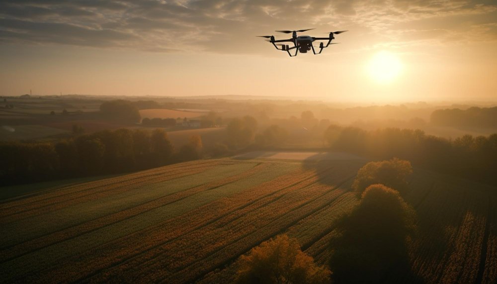
One of the key advantages of using drones for land coordinates technology is their ability to capture high-resolution aerial imagery and collect precise data in a fraction of the time compared to traditional surveying methods. Drones equipped with advanced sensors and cameras can capture detailed images and generate accurate 3D models of the surveyed area. This data can then be used to create comprehensive maps, identify boundaries, measure distances, and calculate land elevations with exceptional precision.
Additionally, drone surveying offers significant cost savings compared to conventional surveying techniques. By eliminating the need for extensive ground-based measurements and manual data collection, drones can reduce surveying time and labor costs. The efficiency of drone surveys also minimizes disruptions to the surveyed area, making it an ideal choice for projects in urban environments or sensitive landscapes.
Drone surveyor training programs in Tamilnadu not only focus on technical aspects but also emphasize safety and regulatory compliance. Participants learn about airspace regulations, flight restrictions, and best practices for safe drone operations. Understanding these guidelines is crucial to ensure the responsible and lawful use of drones in land surveying activities.
The demand for skilled drone surveyors in Tamilnadu is rapidly growing as industries such as construction, infrastructure development, agriculture, and environmental management recognize the value of drone-acquired data. Trained professionals with expertise in land coordinates technology can contribute to projects ranging from mapping and land development to disaster management and conservation efforts.
If you’re passionate about land surveying and want to stay at the forefront of technological advancements, enrolling in a drone surveyor training program in Tamilnadu is a wise choice. These programs offer a unique opportunity to acquire skills that are in high demand and play a vital role in shaping the future of land surveying. By mastering drone technology and land coordinates, you can unlock new possibilities and enhance the accuracy and efficiency of your surveying endeavors.
Drone surveyor training in Tamilnadu offers participants a comprehensive understanding of the various aspects involved in utilizing drones for land coordinates technology. Here are some additional details to provide you with a broader perspective:
Practical Training: These training programs typically include hands-on sessions where participants learn how to operate drones effectively. They gain practical experience in flight planning, drone piloting, and data acquisition techniques. This practical training enables them to handle different scenarios and challenges that may arise during drone surveys.
Data Processing and Analysis: In addition to drone flight operations, participants are trained in data processing and analysis. They learn how to process the collected aerial imagery and sensor data using specialized software. This involves stitching images together, creating orthomosaic maps, generating digital elevation models (DEMs), and extracting valuable information from the acquired data.
Industry Applications: Drone surveyor training programs often focus on specific applications relevant to different industries. For example, participants may explore how drones are used in land development projects, infrastructure inspections, precision agriculture, environmental monitoring, or archaeological surveys. Understanding the practical applications of drone technology in these fields enhances participants’ ability to provide tailored solutions to industry-specific challenges.
Equipment and Technology: Participants gain insights into the different types of drones, sensors, and equipment commonly used in land surveying. They learn about the technical specifications, capabilities, and limitations of various drone models. Understanding the equipment and technology landscape empowers participants to select the right tools for specific surveying tasks and make informed decisions during their operations.
Regulations and Safety: Drone surveyor training programs emphasize the legal and safety aspects of operating drones. Participants learn about the regulations and guidelines set forth by aviation authorities and regulatory bodies. They acquire knowledge about airspace restrictions, privacy concerns, and risk mitigation strategies to ensure safe and compliant drone operations.
Networking Opportunities: These training programs often provide participants with networking opportunities, allowing them to connect with industry professionals, fellow drone operators, and potential employers. Building a network within the drone surveying community can open doors to collaborations, job opportunities, and a deeper understanding of industry trends and advancements.
Ongoing Learning: The field of drone technology is constantly evolving, with new innovations and advancements emerging regularly. Many training programs emphasize the importance of continued learning and staying updated with the latest developments. Participants are encouraged to explore further education, attend workshops, and engage in professional communities to enhance their skills and knowledge over time.
Drone surveyor training in Tamilnadu equips individuals with the technical expertise, practical experience, and industry knowledge necessary to excel in the rapidly growing field of drone-based land surveying. By blending theoretical concepts with hands-on practice, these programs empower participants to harness the power of drones and contribute to accurate and efficient land coordinates technology.
Here are some additional details about drone surveyor training in Tamilnadu:
Specialization Options: Depending on the training program, participants may have the opportunity to specialize in specific areas of drone surveying. This could include topics such as photogrammetry, LiDAR (Light Detection and Ranging) data acquisition, thermal imaging, or advanced data analysis techniques. Specialization allows individuals to develop expertise in niche areas and cater to specialized industry needs.
Field Exercises: To enhance practical skills, drone surveyor training programs often include field exercises. Participants have the chance to apply their knowledge in real-world scenarios and gain experience in different environments. Field exercises may involve conducting mock surveys, capturing data from varying terrains, and addressing challenges encountered during actual surveying projects.
Case Studies and Project Work: Many training programs incorporate case studies and project work to provide participants with a deeper understanding of practical applications. They may analyze real-life surveying projects and learn from successful implementations. Additionally, participants may work on their own projects, applying the knowledge gained during the training to solve specific surveying challenges.
Guest Lectures and Industry Experts: Training programs often invite guest lecturers and industry experts to share their insights and experiences. These experts provide valuable perspectives on the latest trends, technologies, and best practices in drone surveying. Interacting with professionals who have practical experience in the field can offer participants valuable guidance and inspiration.
Certification and Accreditation: Upon successfully completing a drone surveyor training program, participants may receive certifications or accreditation from recognized institutions. These certifications serve as a testament to their competence and can enhance their professional credibility when seeking employment or engaging in freelance surveying opportunities.
Continuous Support and Updates: Training programs often provide ongoing support to participants even after the completion of the course. This support can come in the form of access to additional learning resources, updates on industry developments, or a platform for networking and knowledge sharing among alumni and industry professionals.
Career Opportunities: The demand for skilled drone surveyors is growing rapidly, both in Tamilnadu and globally. Completing a training program in drone surveying opens up a wide range of career opportunities. Graduates may find employment with surveying firms, engineering companies, land development agencies, government bodies, or environmental organizations. They may also choose to start their own drone surveying businesses or work as freelance consultants.
Drone surveyor training in Tamilnadu equips individuals with the necessary skills and knowledge to thrive in the dynamic field of drone-based land surveying. By staying updated with the latest technologies, techniques, and industry practices, participants can position themselves as competent professionals in this rapidly evolving field.