GPR Survey
A GPR survey involves using a specialized antenna to focus electromagnetic pulses (radar signals) of short duration into the ground. These signals propagate and
Read More


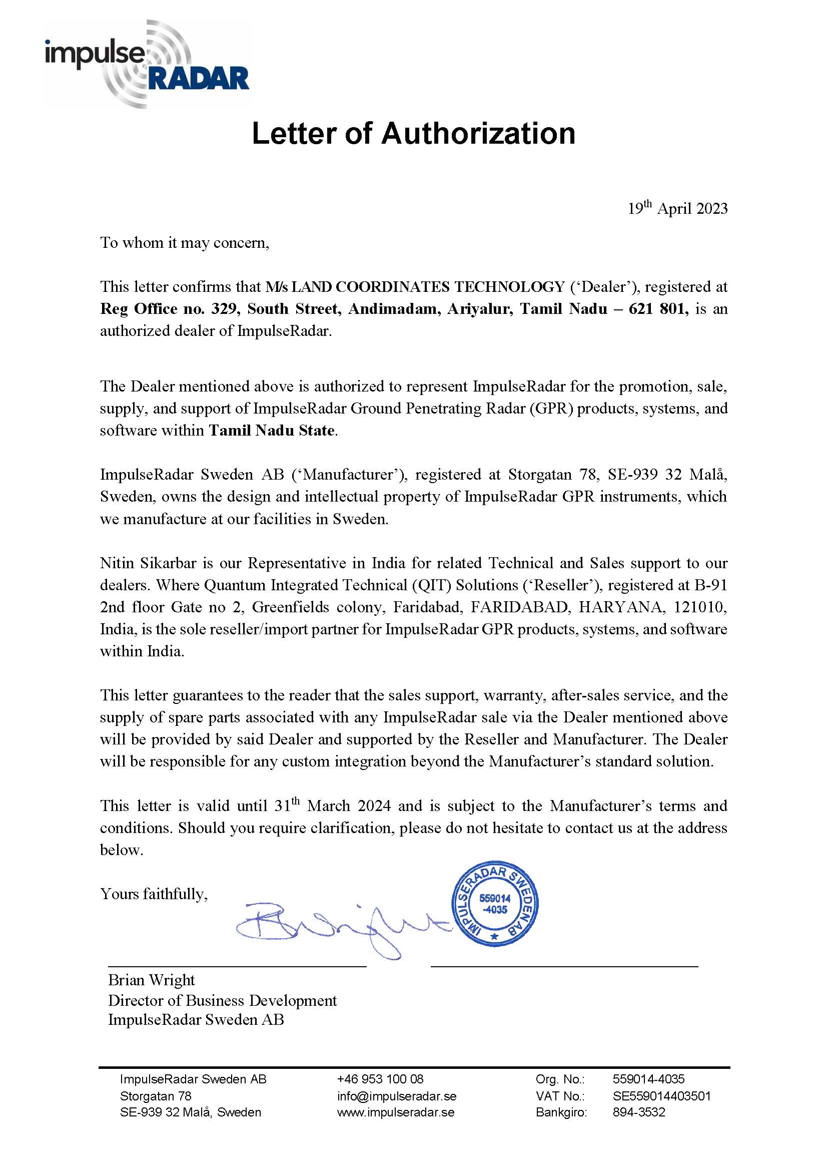
Land Coordinated Technology was established with the aim to provide International standard solution and Geomatics data to the constantly developing world.

LCT solves all the Civil based problems by rendering its services on Traffic and pavement works.

LiDAR is an advanced survey technology which scans the features in the area of interest with the highest accuracy point clouds. The instrument does a 360° scan of the area as a point clouds.

Capturing huge amount of large scale data in a short span of time has always been a difficult task. UAV/Drone survey has come as a boon to the geospatial industry for data acquisition.


Happy Clients

Customers Globally

Our Team

Client Rating

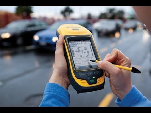
LCT supplies conventional to advance Survey Instruments And Accessories of leading OEMs on a very Cost effective basis

Good Service. On time delivery of Instruments and Accessories.


Professional Training with Advanced Instruments and Experienced Trainers.

Industrial Training with Technically qualified faculties.
Trusted Dealer for Survey equipment purchase, service & calibration.
Both Technical and equipment support is satisfactory.
Perfect Instruments and accessories at Genuine price.

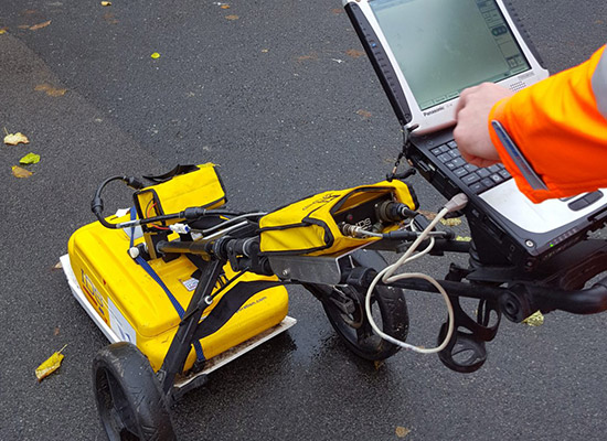
A GPR survey involves using a specialized antenna to focus electromagnetic pulses (radar signals) of short duration into the ground. These signals propagate and
Read More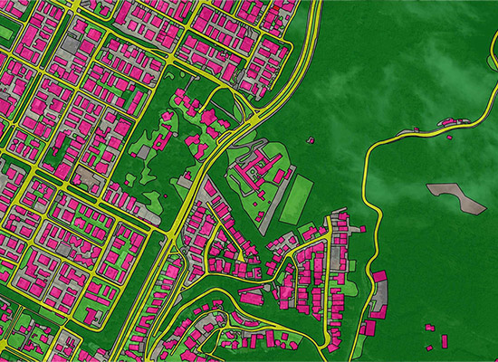
GIS deals with the information about the earth and its features. The spatial and non-spatial data of the Earth’s surface are managed precisely with the
Read More
LCT has well qualified civil engineers who have esteemed experience in handling civil related works. We have associates qualified from Institution of Valuers.
Read More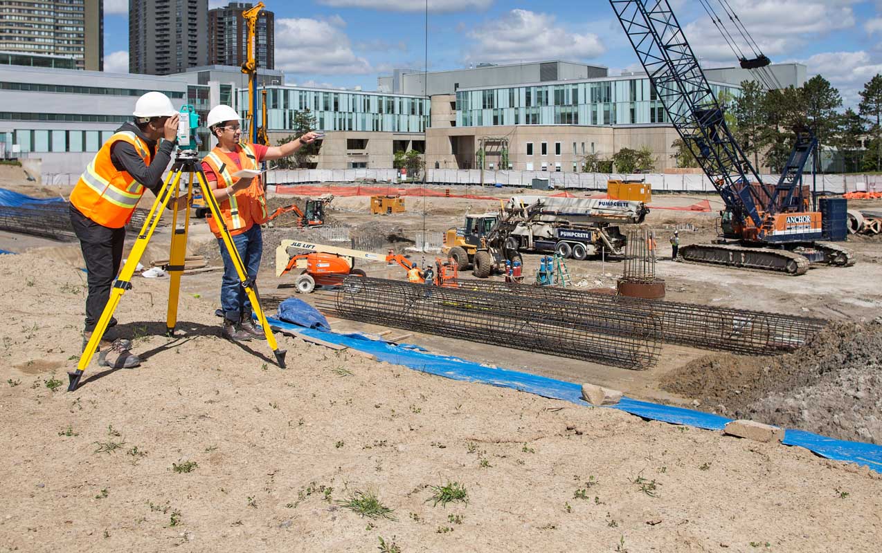
LCT has well qualified civil engineers who have esteemed experience in handling civil related works. We have associates qualified from Institution of Valuers.
Read More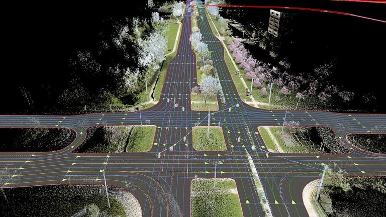
LCT has well qualified civil engineers who have esteemed experience in handling civil related works. We have associates qualified from Institution of Valuers.
Read More
LCT has well qualified civil engineers who have esteemed experience in handling civil related works. We have associates qualified from Institution of Valuers.
Read More


LCT provides Training on the Civil and Geomatics platform with its expert trainers. We provide Government of India approved and recognised course.
Get a professional BSS Diploma in Civil Draughts man with our widely recognized certificate programme.
Students get theoretical and practical knowledge from our Industrial experts. Our students are made to develop the skills to face the real world projects confidently.

Drone surveying is a rapidly growing field that uses unmanned aerial vehicles (UAVs), or drones, to collect high-resolution data for a variety of applications such as mapping, construction, land surveying, and environmental monitoring.
View Course Details
Choose wisely and move ahead in your career by taking the GIS Professional Certificate course from LCT. This is a best course which covers all the advanced technologies in the syllabus. The course will be taught by industrial experts, so the students get abundant knowledge on the technology and the real world projects.
View Course Details
CAD (Computer-Aided Design) Draftsman training course is designed to train individuals in the use of computer software and technology to create technical drawings and 3D models used in the manufacturing, engineering, and architecture industries.
View Course Details